Buenos Aires Ezeiza International Airport (EZE)
Driving Directions / Travel by Car
(Buenos Aires, Argentina)
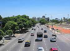
Just over 30 minutes to the southwest of downtown Buenos Aires, Ezeiza International Airport (EZE) is close to a number of major roads. These include the N3, the N205 (Ruta Nacional), the N210 and the P4, all of which lead to the city centre.
Nearby Ezeiza Airport you will find the Club Hipico, which is known for its equestrian attractions. Cities and towns to the north and also close to the city of Buenos Aires include Ituzaingo, Moron, San Justo, Avellaneda and Lanus. To the east of EZE Airport you will find Berazategui, Florencio Varela and Quilmes, while San Vincente lies to the southwest.
Directions from Ezeiza International Airport (EZE) from downtown:
- Travel along the General Ricchieri Expressway in a north-easterly direction towards the city
- Continue for around 30 km / 19 miles
- Take the exit at Avenida 9 de Julio and head north, following the signposts along the way. The airport is signposted locally as the 'Aeropuerto Ezeiza'
Directions from downtown Buenos Aires to Ezeiza International Airport
- Travel along the Avenida 9 de Julio in a southerly direction
- Join the General Ricchieri Expressway and head south-east
- Continue for around 30 km / 19 miles and follow the signs
